
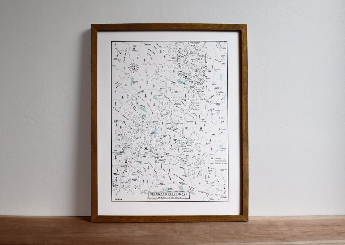
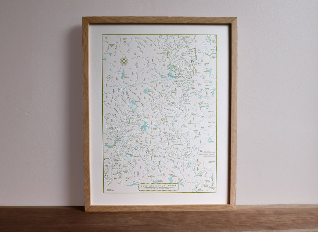
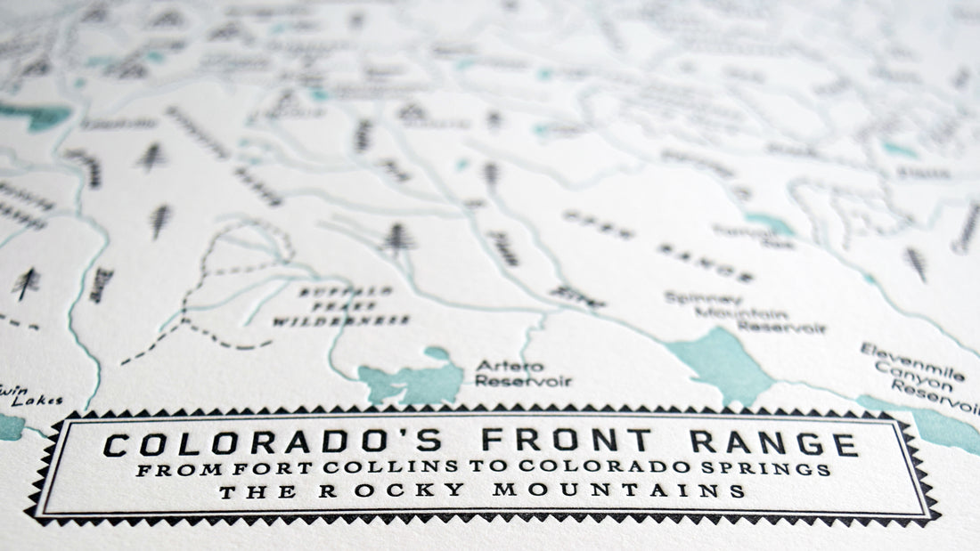


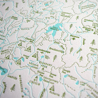

Colorado Map, The Front Range from Fort Collins to Colorado Springs
Paper size: 14 x 18"
Color:
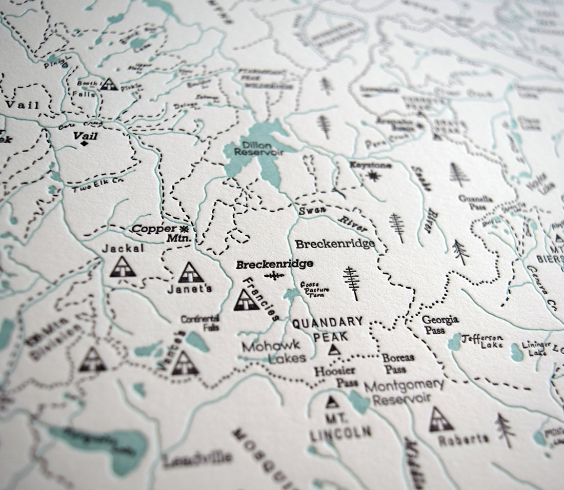
Light Blue (water) / Black (text & outlines)
or
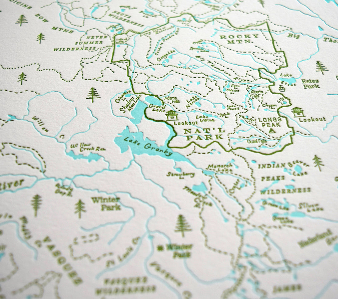
Turquoise (water) / Green (text & outlines)
Sold UNFRAMED
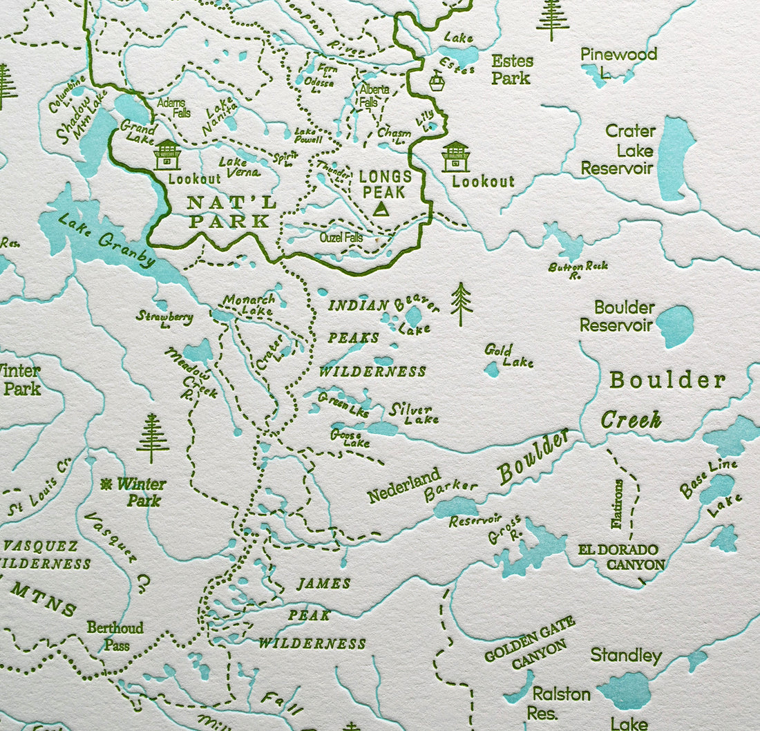
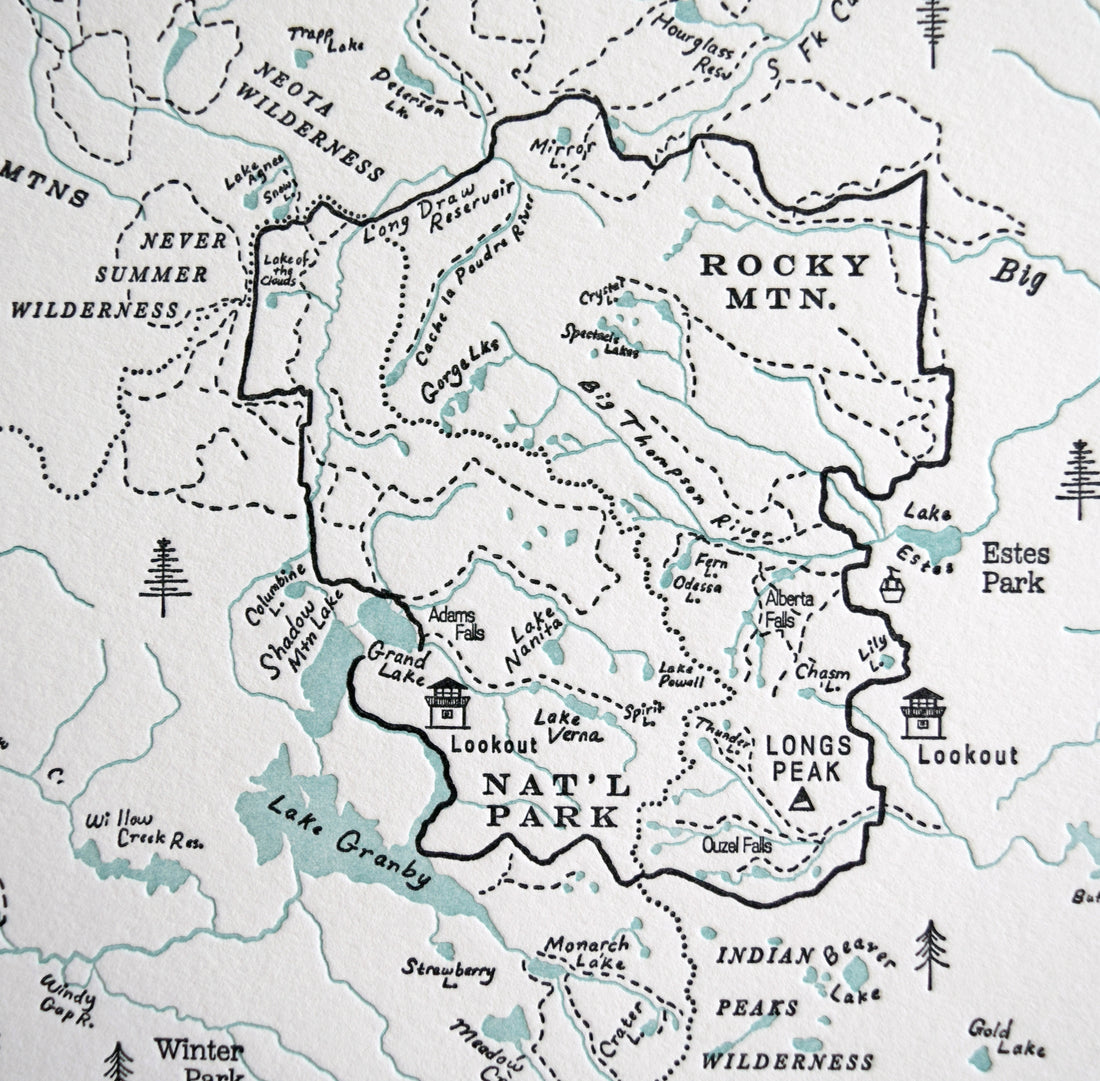
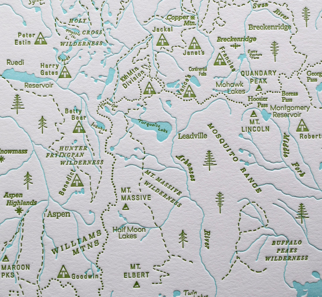
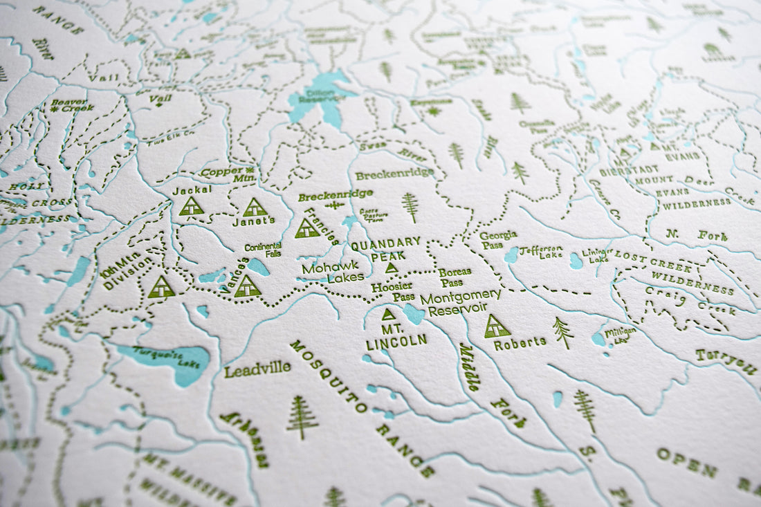
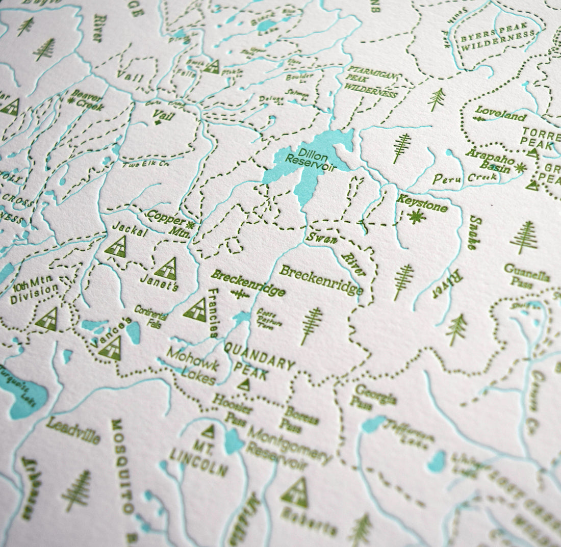
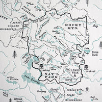
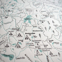
This map charts the front range of Colorado and includes the wilderness areas around Rocky Mountain National Park, Boulder, Summit County (including Vail and Breckenridge), Aspen and Colorado Springs.
As with all of our charts this map features trails (including the Continental Divide Trail), watersheds, and peaks. Additionally we've highlighted all the ski areas.
All I can say is that in making this map I'm now really in awe at how many incredible places there are to enjoy nature within striking distance of the major cities in Colorado.
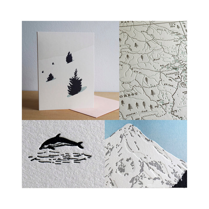
Printed on 100% cotton paper.
Ships flat in a firm mailer.
Environmentally friendly business practices are a priority for us. We generate electricity for our shop with a solar PV system, employ low VOC inks, and use sustainable and biodegradable materials whenever possible.
Orders ship flat within 2 business days of purchase via USPS or UPS Ground. Contact us if you need your order expedited or have any questions. info@quaillanepress.com
All of our products are printed on heavyweight (acid-free) cotton paper with archival inks.
More about Quail Lane Press
We print our products in house on our letterpress machines in the beautiful state of Oregon.
We try to keep our printing and packaging processes as eco-friendly as possible. Our shop is connected to a solar array and battery backup for power, we use low VOC inks and solvents, and we use as little plastic as possible to package and ship all of our prints and cards.
Quail Lane Press is a woman-owned, black-owned business.